|
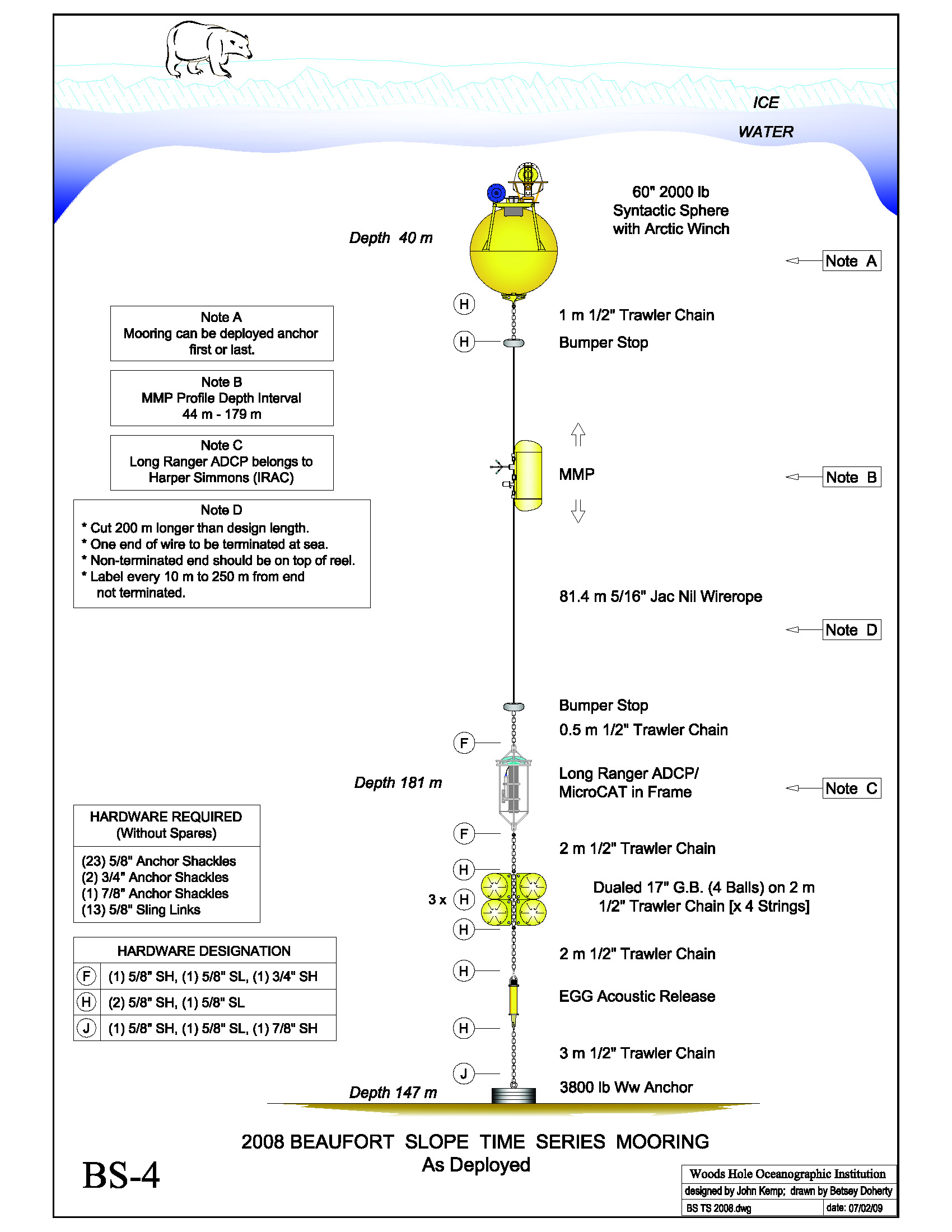
The mooring was deployed off the USCGC Healy on Aug 13, 2008 at 71° 24.090' N, 152° 2.820' W.
It was recovered on July 29, 2009.
Instrumentation included:
- Arctic Winch, on subsurface float
- coastal moored profiler "CMP"
- 75KHz ADCP near bottom
- SBE39 "microcat" near bottom
Unfortunately there was some confusion about the name of this mooring. It was deployed during the 2008 NOPP cruise,
following a set of mooring deployments along an offshore line located further east (downstream) near 149° W. It
was not known until late into that cruise that a mooring would be deployed at the "BS3 site" near 152 ° W.
By that time, one of the moorings along the 149° W line had already been named "BS3". Therefore, on that cruise,
the "additional" mooring near 152° W, launched last, was named "BS4". It is this name that was used, for example, in the above mooring diagram.
With renewed funding to occupy the 152° W site for a longer time series under AON, tying together and extending occupations
from the earlier SBI and NOPP programs, a decision was made to re-name the 2008-2009 152° W mooring "BS3" to
reflect the common location.
|