

Deployment 2003 to 2004:
Deep Microcat "SBE37"
Deep Microcat "SBE37"
plot curtesy of Dan Torres
|
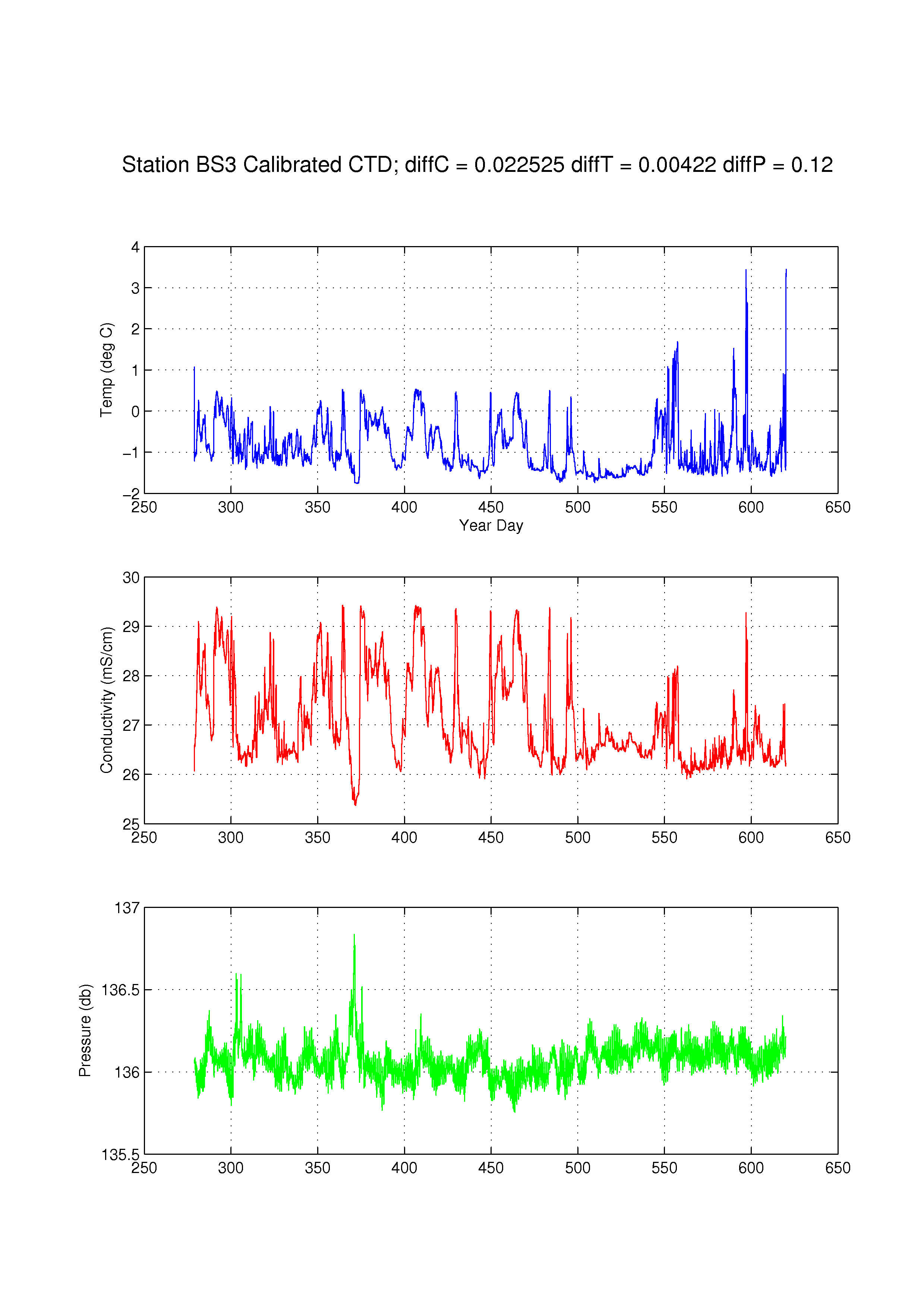
Deployment summary: Duration:Oct 5, 2003 to Sept 10, 2004 Location: 71° 23.69' N, 152° 2.81 W Variables measured: temperature, conductivity, pressure Sensor information: SBE37-SM V 2.6b SERIAL NO. 2135 ; Instrument settings: sampling interval 1 hour Calibration: strapped onto SBE911 CTD for comarison Processed data: contained in the matlab file sbi04_bs3_mc2135.mat , described in mc_format.txt |
|
Data processing: The post-processed data were provided by Dan Torres (WHOI). In an email from 2011/12/19, Dan provided the following comments (my additions in square brackets): This data was calibrated using the Seabird 911 CTD. When we recovered the Microcats, we attached them to the CTD rosette and did casts. I applied the offsets to the data. [In 2003, ] We did cals in between [mooring] deployments. And we did turn around at sea. Each year got its own cal. I have attached the master spread sheet that we used for the calibration info. We did a lot of cals with the Microcats and the EMCTDs that were on the CMPs and MMPs. It's quite a lot to digest so have a look and ask me questions. The basic procesdure was to calibrate the SBE911 CTD using bottles. Then calibrate the Microcats and EMCTDs using the CTD data. We would do a cast with the MCs and EMCTDs attached to the frame. We tried to lower them down to a depth the same or close to the depth where they were deployed. Then the data was averaged for that depth. And compared to the mean 911 data at that depth. The constant offset was applied to the MC and EMCTD data. This spreadsheet was done by Sarah Z[immermann]. She did a lot of the dirty work. |